CRM Integration
Powerful features and tools that integrations Real-Time Mapping with your Existing CRM System.
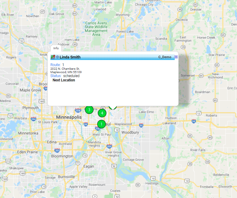
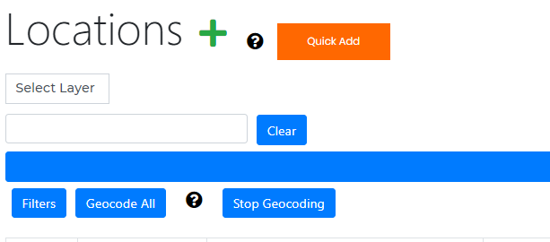
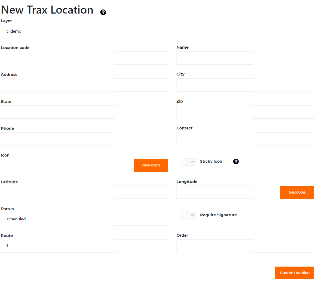
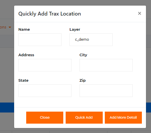
Creating Customer Locations on the Map.
ENTER DATA DIRECTLY
The system provide robust tool to Add/Edit/Delete custom location data.
Add Sub Assets Add images/documents.
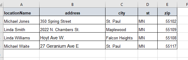
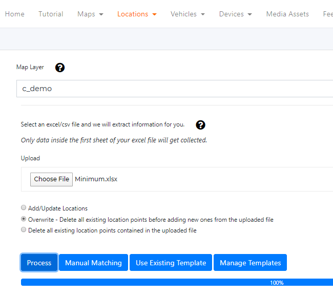
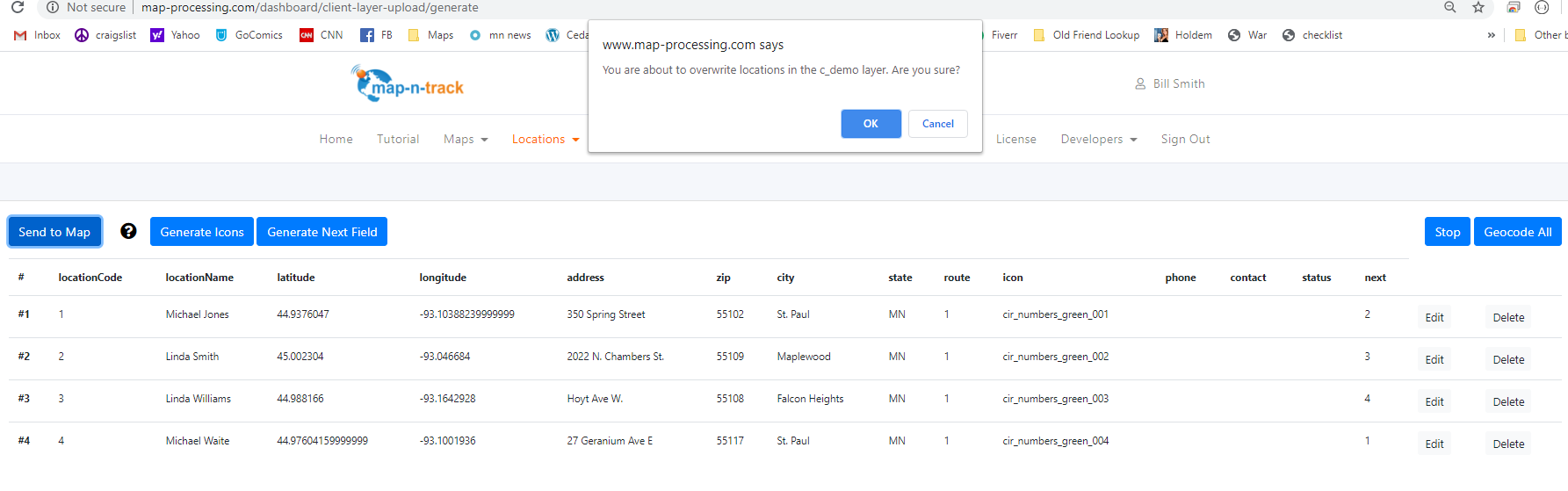
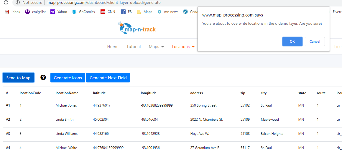
Excel File Upload
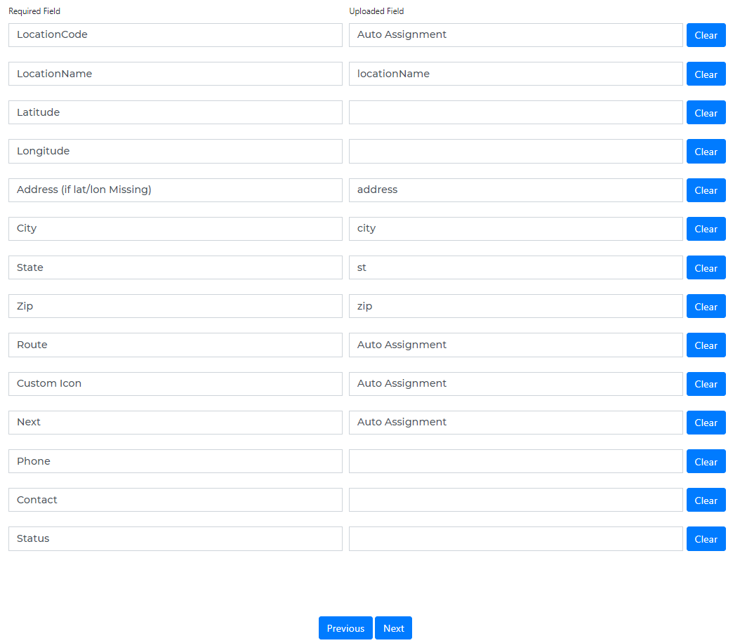
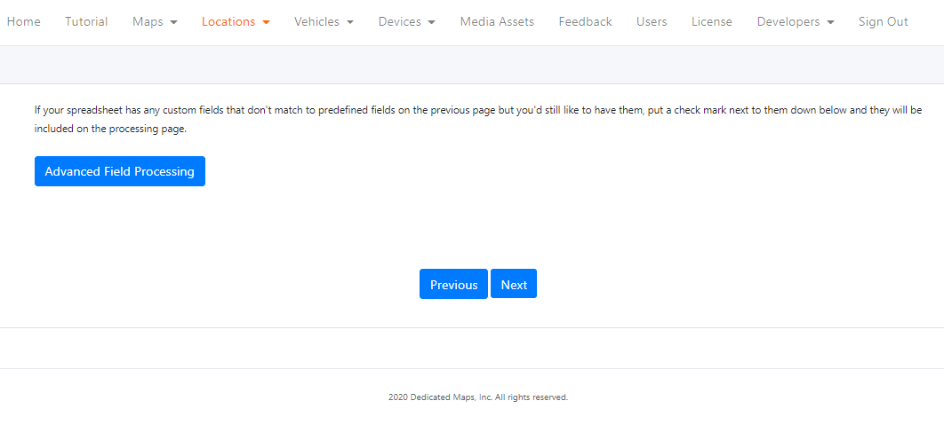
Field mapping
User defined template.
GeoCoding
API integration.
Download collected data.
Secure
Upload / download / edit locations using a private API Key.
Uploading an Excel Spreadsheet to a map.
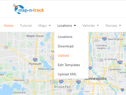
Manually entering locations.
Real-time Tracking
Vehicles (boats, trucks, bicycles, etc.)
User Defined data
Driver
license
images
sub-assets
Tracking Devices
The movable asset (vehicle, etc.) are assigned a tracking device.
Types of devices
Phone App
OBD car device
Satellite trackers
Map Updates
See location of vehicles on the map in real time.
Track History
Track last hour, day, or week history.
Download Collected Information to Your CRM System.
Data Collection
The system allows you to collect data when the employee interacts with the customer.
Data Collected
Basic arrival and departure times.
User defined questions and answers with the phone app.
Data Presentation
The system will show location and vehicle status on the map in real time.
Display status of locations
Not started
Completed
Issued
Feedback Answers
Signature
Download Data
The collected information can be downloaded.
Data download
Manual excel or json format
API download
Predefined and custom templates.